

Lauwersmeerdijk, the Netherlands
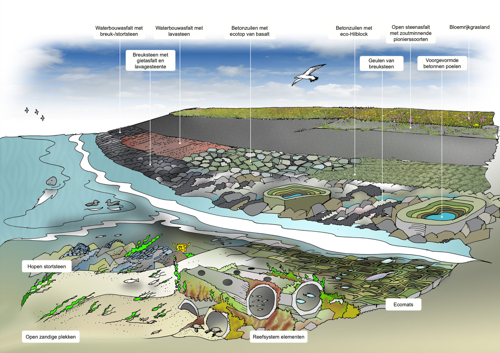
The Lauwersmeerdijk is located in Groningen. It does no longer meet the requirements for flooding protection and must therefore be reinforced. The dike is located along the Wadden Sea, which is a valuable area for Dutch nature. Therefor this construction project offers a unique opportunity to restore local ecosystems and contribute to the growth of marine populations. To learn more about the effects of artificial reefs in the Wadden Sea, Waterschap Noorderzijlvest has started the biggest artificial reef research project ever in the Wadden Sea. Various artificial reefs are installed and monitored to learn more about the positive effects on the ecosystem. The goal of this project is to develop a vital nature-inclusive coastal zone along the Wadden coast, where humanity and nature both thrive.
Monitoring the artificial reefs with researchers
Project development:
1. Installation of artificial reefs & tidal pools


ReefSystems has delivered 7 artificial ''MOSES'' reefs and 6 ''Reefpools'' for this research project. The MOSES reefs are build up on a 2m by 2m baseplate and create a colonizable surface of 35 m² each with interesting microhabitats for various organisms. The Reefpools function as intertidal habitats along the dike by mimicking natural rock pools. Researchers from Van Hall Larenstein University will be monitoring these artificial habitats to find out its effects on local marine populations.
2. Monitoring of biodiversity & marine population increase


One year after installation the artificial reefs are lifted out of the water for the first monitoring. It was amazing to see the result. The reefs were full of life and a lot of (endangered) species were seen and counted. See the video on the top of this page for a detailed explanation of the monitoring.
3. Determine final design for Lauwersmeerdijk
After two years of monitoring a final design for the whole 7km dike is made. The best functioning artificial reefs will be selected to be installed in 2024.
Background information of project
Since 2018 this project is being developed by multiple parties*. After exploring the possibilities to reinforce the dike, methods for nature inclusive design were explored. This led to the ambition to create a natural transition between the sea, the intertidal zone and the dike.
*Groninger Landschap, Natuurmonumenten, Staatsbosbeheer en Natuur, Milieufederatie Groningen, Rijkswaterstaat Noord-Nederland, gemeente Het Hogeland, provincie Groningen, ingenieursbureau Arcadis en aannemerscombinatie Waddenkwartier, Heuvelman Ibis, het Waddenfonds en de Programmatische Aanpak Grote Wateren.
The Intertidal zone
The intertidal zone, also known as 'shore', is the area above water level at low tide and underwater at high tide. This area can include several types of habitats with various species. The intertidal zone along the Lauwersmeerdijk functions as an important area with habitats for many aquatic animals from the Wadden Sea. Due to coastal development this area is vulnerable and therefore support for nature in necessary.
Media


Any questions? Please contact us on info@reefsystems.org